Select a
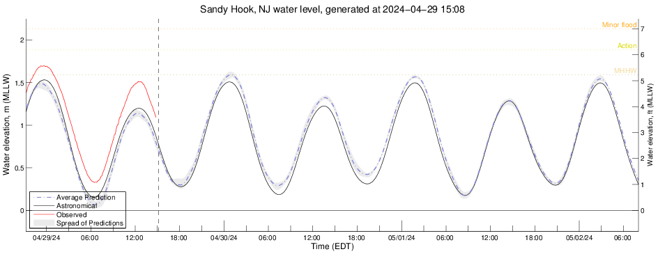
Sea Level Height
Plot for
Sandy Hook, NJ
Average (selected members)
All members
Comparisons with other models
NOAA.NCAR.WRF.ARW.Hires
NOAA.NCEP.WRF.FV3.Hires
NOAA.NCEP.NEMS.NMMB.NEST
NOAA.NCEP.WRF.NMM.NAM
NOAA.NCEP.WRF.ARW.HRRR
NOAA.NCEP.WRF.ARW.RAP
SBU.WRF.ARW.GFS
SBU.WRF.ARW.NAM
Tides only (grid "2", 2D)
Tides only (grid "GSB v4")
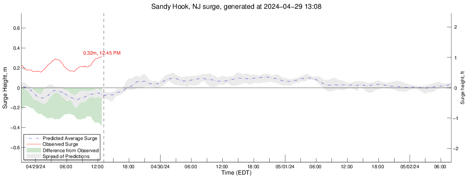
Surge
Plot for
Sandy Hook, NJ
Wind Vector
plot for
sh
Note: the length of the vectors has been compressed for clarity. Use the magnitude vs. time plot below for true wind speeds.
Wind Magnitude
Plot for
sh
Wind Direction
Plot for
sh