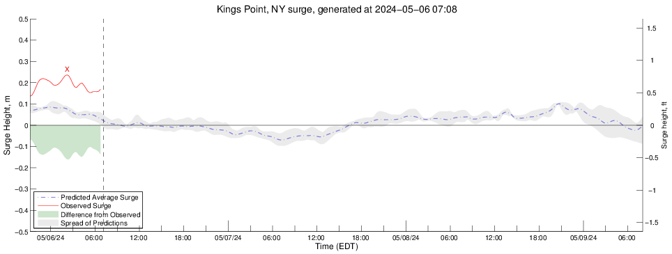
Surge Plot for Kings Point, NY
Wind Vector plot for Kings Point, NY

Wind Magnitude Plot for Kings Point, NY

Wind Direction Plot for Kings Point, NY

Pressure Data plot for Kings Point, NY
|
|
Surge Plot for Kings Point, NY |
|
|
Wind Vector plot for Kings Point, NY |
| Note: the length of the vectors has been compressed for clarity. Use the magnitude vs. time plot below for true wind speeds. |
|
|
Wind Magnitude Plot for Kings Point, NY |
|
|
Wind Direction Plot for Kings Point, NY |
|
|
Pressure Data plot for Kings Point, NY |
|
|
|
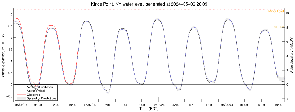
Disclaimer: This model is under development and predictions for sea level height are for research purposes only. They should never be used for navigational purposes or emergency planning under any circumstances. |